History
Built around 1810 for carding and spinning wool. The mill was powered by water from the large triangular lodge situated several feet above the mill. It converted to cotton spinning in the late 1830's whereafter the factory was enlarged to incorporate several thousand spindles. Sandiford and Asworth note 3 to 4000 spindles for spinning cotton waste yarns, 3 pairs of mules for spinning raw cotton and 5 reeling frames for winding the spun yarn into hanks in preparation for the dyer. In addition 30 looms made cloth from the spun yarn.
Here we can witness in one mill the transition from industrial unit focusing on producing wool for the outworker, to multi-faceted industrial unit focusing on producing cloth in a variety of forms and ranges - reeling in the majority of processes under one roof.
During the peak of its production a row of cottages were built to house workers. Later a steam engine was incorporated into the factory which helped produce gas to light the mill. A school room was also incorporated indicating the important role of the mill in the northern outback, in social matters during this time.
Remaining Archaeology
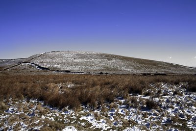
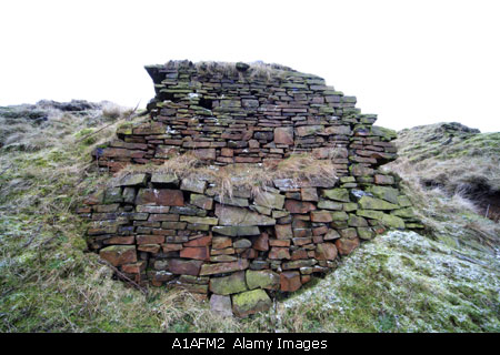
Little remains of the mill (although more than I expected). The plan form can still be made out (if one consults Sandiford and Ashworths drawings) against the hillside. The biggest remaining impact of the mill is on the landscape, with the huge earth banks of the lodge rising high above a rubble stone revetement. It remains empty, and was filled by the numerous springs in the area, and not the brook itelf. An opening in the south west corner indicates where the waterwheel must have been. Also, a large oval indentation is present to the north which may have housed a boiler or gas tank of some description. Whilst I was up there I found the remains of a china tea-cup (surely not from the mill or outworkers buildings?). Iron pipes protrude from behind a stone revetment or wall tucked up against the lodge. Beyond the great oval indentation the stone remains of a square building survive. To the east of the lodge, humps and bumps and some slight standing walls indicate the location of the row of houses. Of interest to me are the remains of a Shippon which looks suspiciously like a ww2 air raid shelter.
Project Links
Touched by the hand of God
Shippon at Cheesden Pasture Mill
Lightbox (updated regularly)
Images of Cheesden Pasture Mill
Location
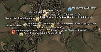
You can view all of the Cheesden Valley mills on my Google Earth archi-map.
Access is from my archi-map page on my website.

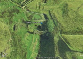
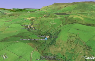
Satellite Image of Cheesden Pasture courtesy of Google Earth
Do you have more information?
Please post a comment if you have more information or any corrections are required
References
There are a number of references which require acknowledgement. Firstly the pioneer book by A.V. Sandiford and T.E. Ashworth called The Forgotton Valley is an important source of information and is available from the libraries at Heywood or Rochdale. For a general background Owen Ashmore's Industrial Archaeology of Lancashire is a must. There is also a good archive at Heywood Library.


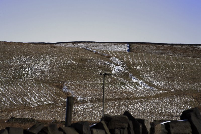
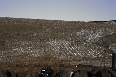
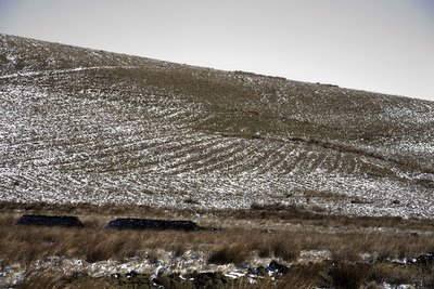
 In the photo above you can see the full outline of the lodge and the indentation where water would have collected to power the waterwheel.